
One geologist named Will even turned that into a hobby. He spends hours on Google Earth looking for all sorts of interesting places that most of us will never get to visit. From mesmerizing mining sites to sand-covered abandoned settlements, check out the most interesting thing Will found on Google Earth in the gallery below!
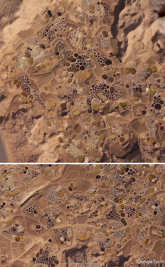
“It looks like an abstract painting. My first thought was a huge archeological excavation site. Turns out that was wrong. These pits are used in a very old fashioned salt extraction operation.”
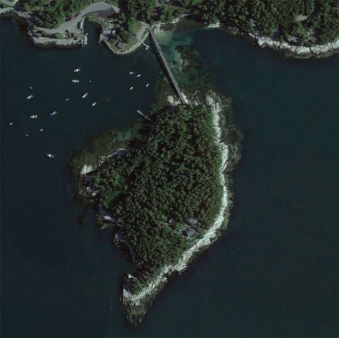
“This is a private island on the coast of Maine. The bridge has a gate, and the house overlooks a shipping lane in Penobscot Bay. I’d spend all day watching boats, drinking wine, and telling the world to fuck off.”
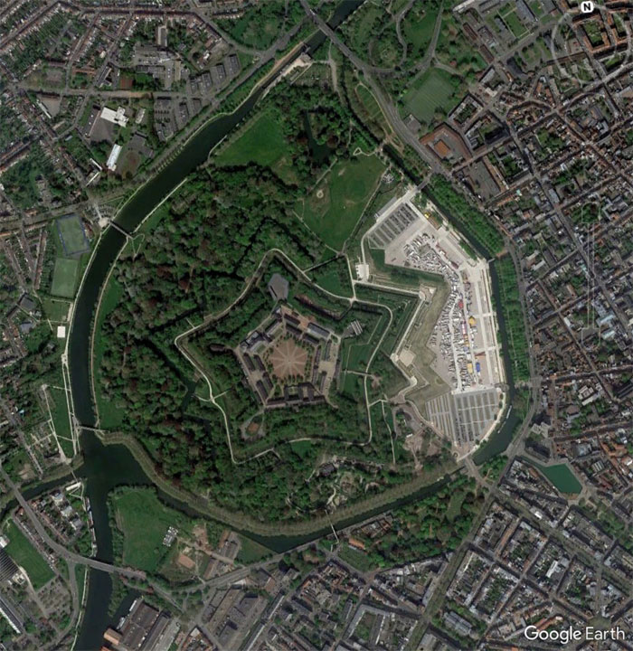
“A fort in Lille, France. I love finding forts while exploring. Star forts are an easy to spot shape. I esp. like finding forts in the middle of cities.”
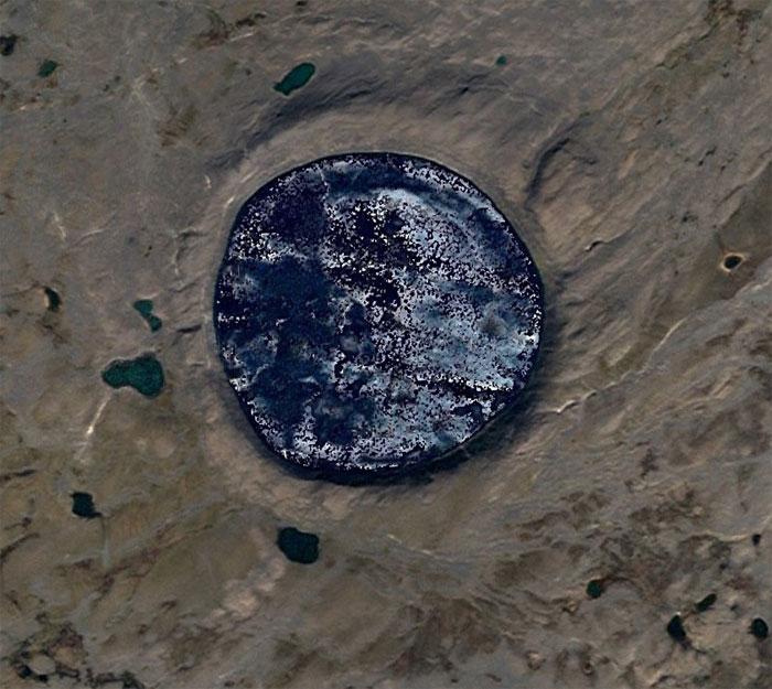
“Here is a perfect meteor crater. It has a very nice raised rim. I bet if you mapped out the lake bed you would see a central peak too.”
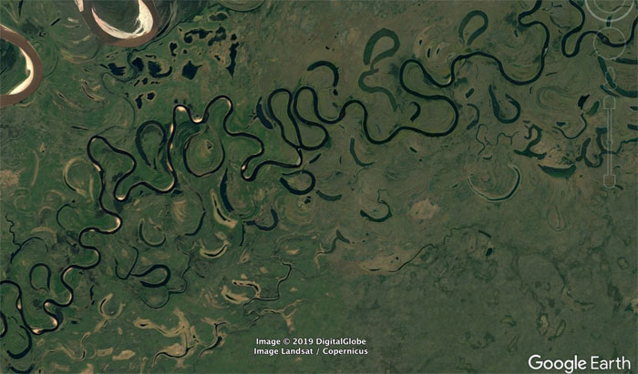
“A very sinuous river. This is a good illustration of how oxbow lakes form. In the middle of the image you can see where a meander loop is being actively cut off.”
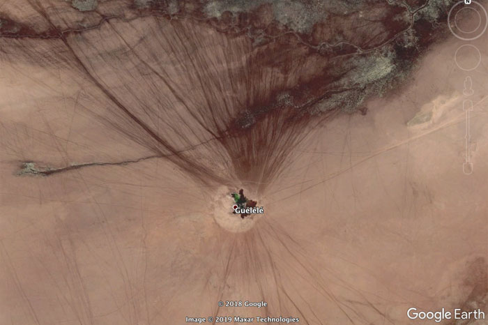
“A real live oasis!. Not all of these tracks are from cars. The smaller ones must be animal.”
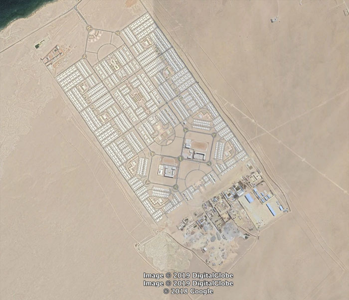
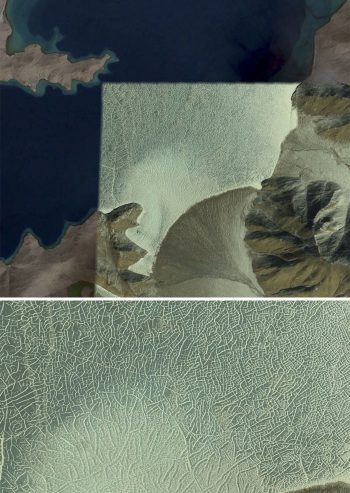
“I couldn’t find anything about this strange place. It’s a huge, planned settlement near Namibe, Angola. It seems to have been constructed around 2013-2014. It also appears to be uninhabited due to no vehicles. Does anyone know anything about this place.”
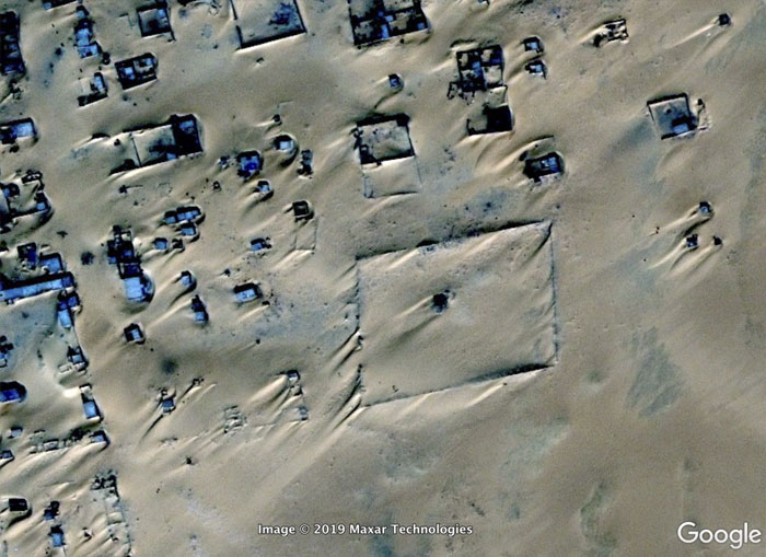
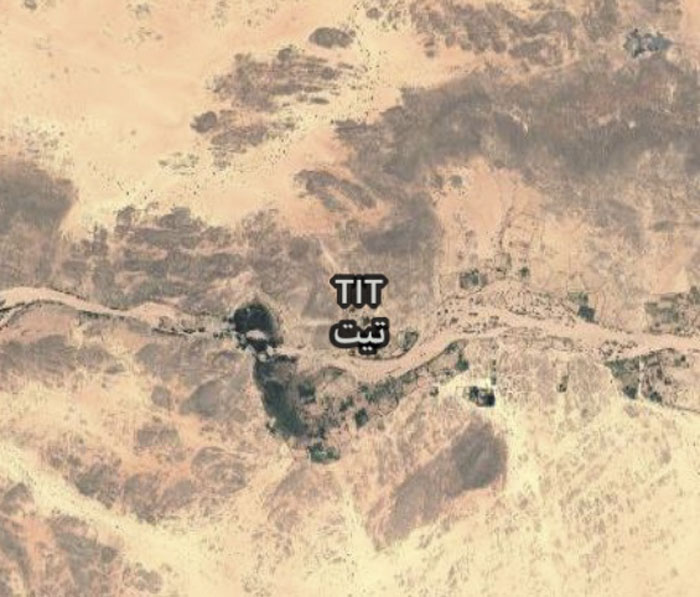
“This is Assamakka, Niger, a community that appears to be fighting a losing battle with the sands.It’s easy to see the prevailing wind direction here.”
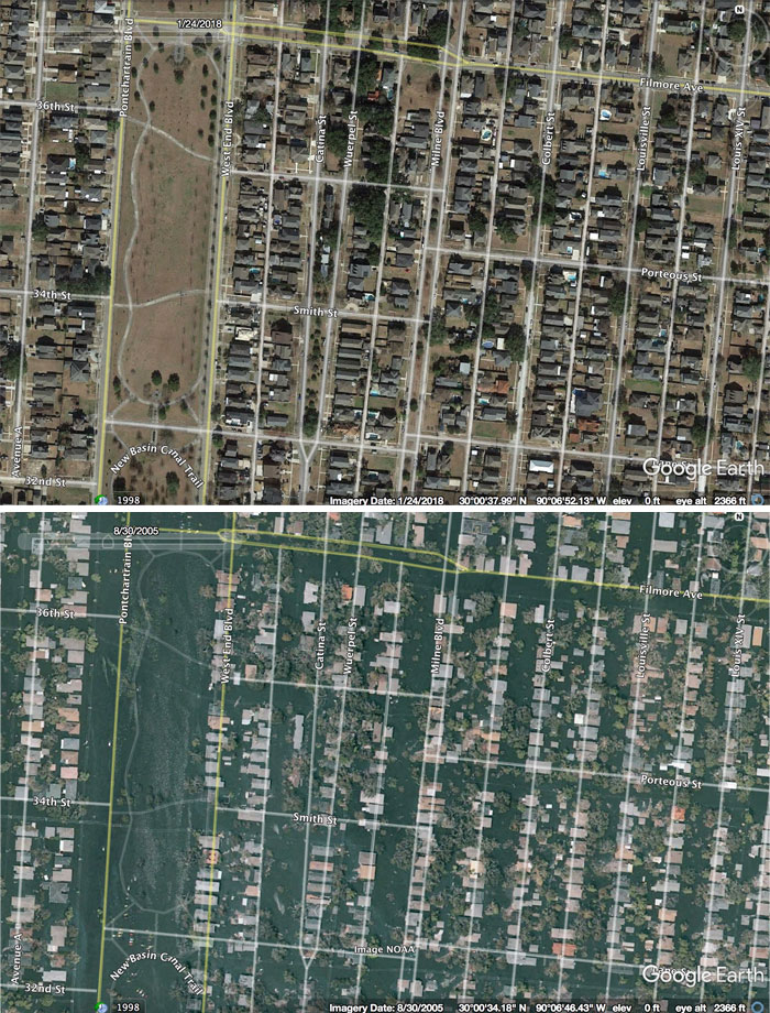
“This is the Lakeview neighborhood.
1 day after Katrina.”
“The circular reflections of these waves is cool.”
“I recently read the book, “Skeletons on the Zahara.” It tells the true story of some US sailors who wrecked on the NW African coast in 1815. It sucked for them. I wanted to see if I could find a ship wreck. I figured a desert coast would preserve metal wrecks well. It didn’t take to long to find this one in NW South Africa. It looks like a modern ship, and sure enough it wasn’t there in 2003 (the oldest picture available).”
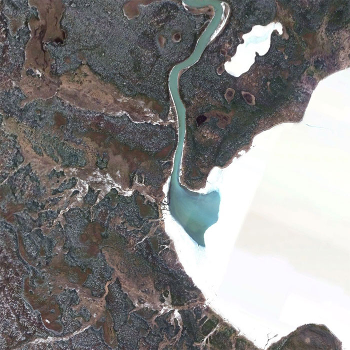
“A river cutting a hole in the ice.”
“A lake somewhere on the Tibetan Plateau in summer and winter.”
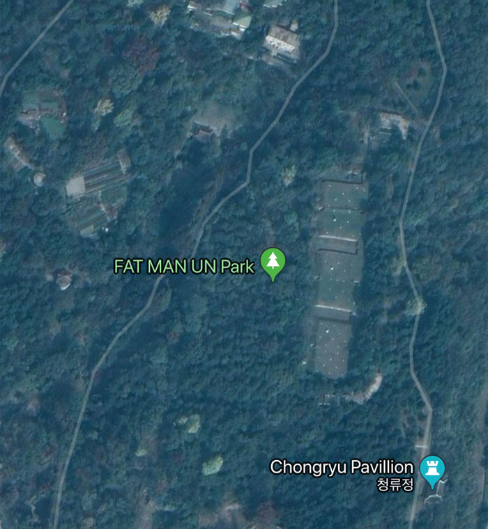
“A park in Pyongyang, North Korea. Someone at Google in going to be in hot water with the glorious leader.”
“Hey, wanna go out?”
“Cant’, my….”
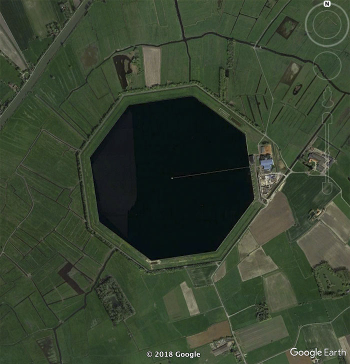
“This is some sort of reservoir in Belgium. I’ve never seen an octagonal pond before. I wonder why they made it that way.”
“When she wants to go to pound town, but you can only take her to…”
“A volcano poking up out of the South Pacific. I’m not sure if this one is growing or eroding away. Seems like the rich people in boats are having a good time.”
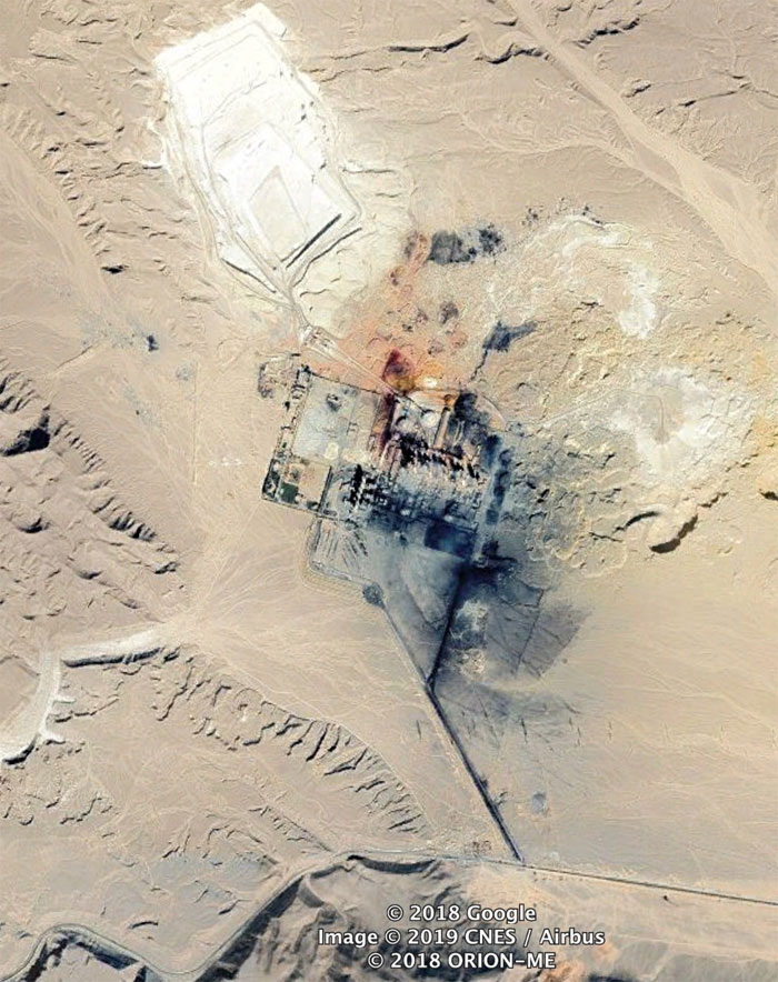
“While looking up that lava flow in New Mexico, there were some maps showing some nuclear bomb test sites nearby. This must have something to do with that. I’m fairly sure this is the sight of the first nuclear detonation.”
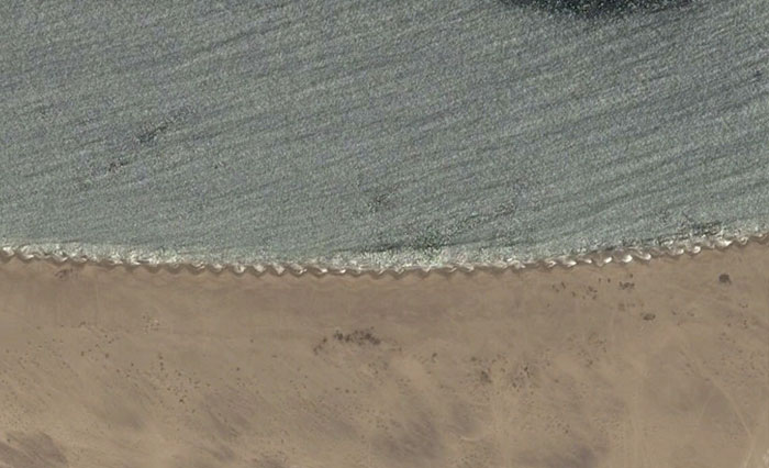
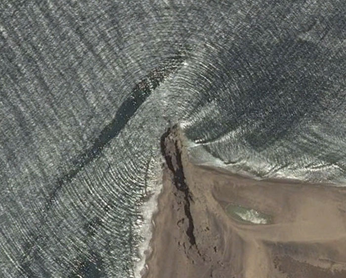
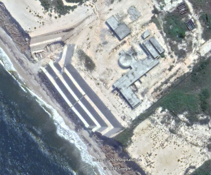
“I’ve never seen this saw-tooth pattern on a beach before.”
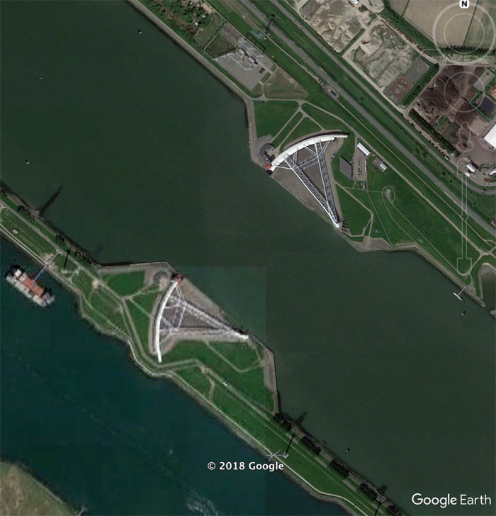
“Some huge gates protecting Rotterdam from the North Sea waters. What an amazing feat of engineering.”
“HA. Nice.”
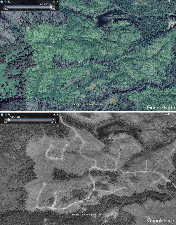
“The dark green lines caught my eye because they didn’t make sense. My guess was that they were logging roads, but then why are they more vegetated than the surrounding fields?
Going back in time. They are certainly logging roads. I guess different plants grew on the churned up roads, thus the different colors seen in the last image.”
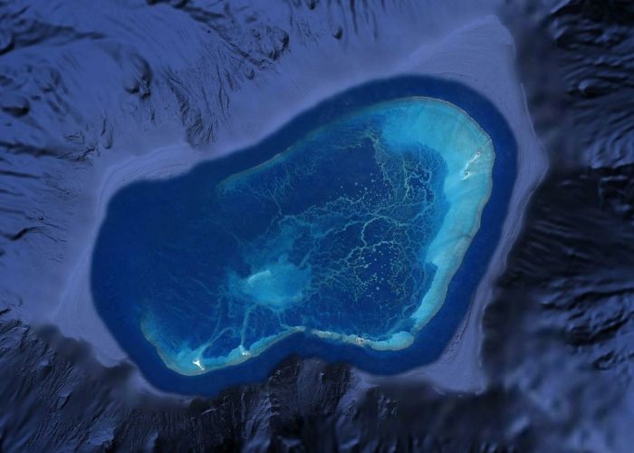
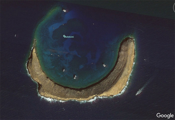
“Atolls:
Hot spots not only punch holes in the crust, but the also raise it up and heat it. As the plate moves away, it cools and subsides. The mountains also subside, and also erode. If the mountains are formed in a tropical climate a reef will form around it’s edges. If the coral growth can keep up with the relative sea level rise from the subsidence, then the reef will survive while the mountain sinks and eventually disappears below water level. If that happens you will get a circular ring of reef with an open lagoon in the center like the atoll above. At one point there was a volcano in the center of that lagoon. It’s a cool example of biology and geology interacting and biology winning, so to speak.”
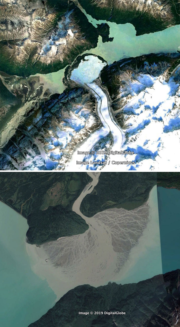
“A glacier flowing out into a lake. The presence of a connecting stream suggests the 2 parts of the lake are at different levels. The glacier made an ice damn. That’s pretty cool.
A river trying to do the same thing in another lake.”
“I think this is a coal fired power plant in Egypt. Lookin a little nasty.”
“This was a pit of an optical illusion. At first it looked like a pyramid, but the coastline is a bluff, so it must be the inverse of a pyramid. My guess is an abandoned evil villain’s mansion.”
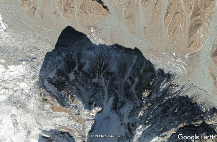
“The shadow of a mountain.”
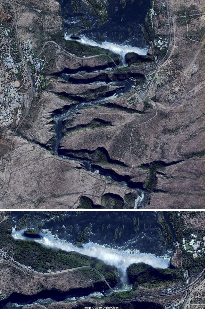
“The Zambezi River downstream of the falls. That’s a very unusual path for any river.”
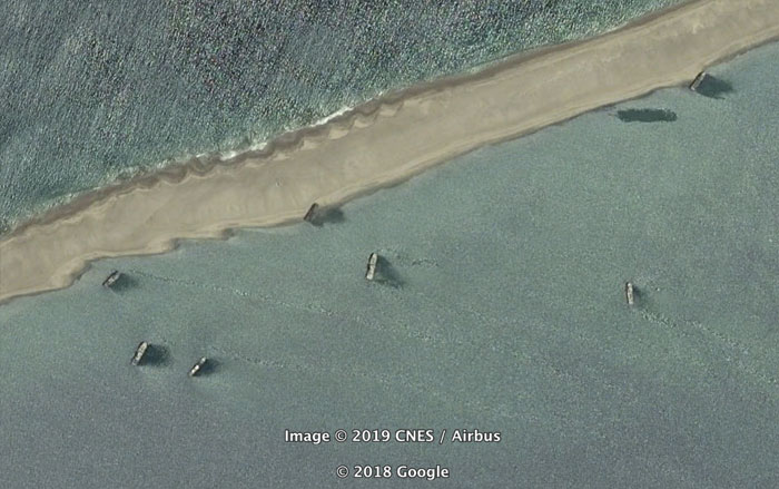
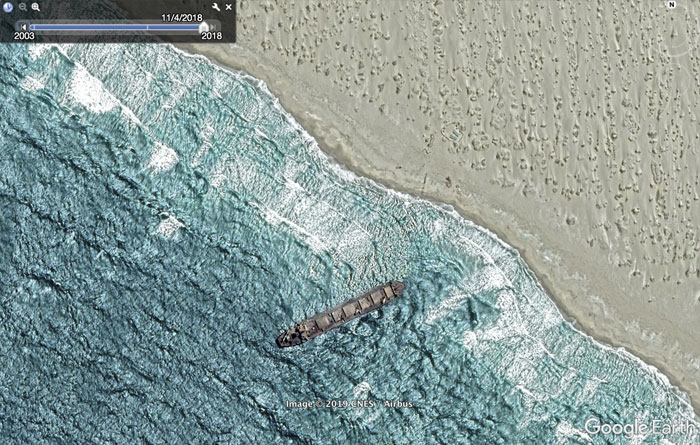
“More ships near Tombua, Angola. These might have been intentionally abandoned. They were also not here in the 2003 pics.”
Leave a Comment