
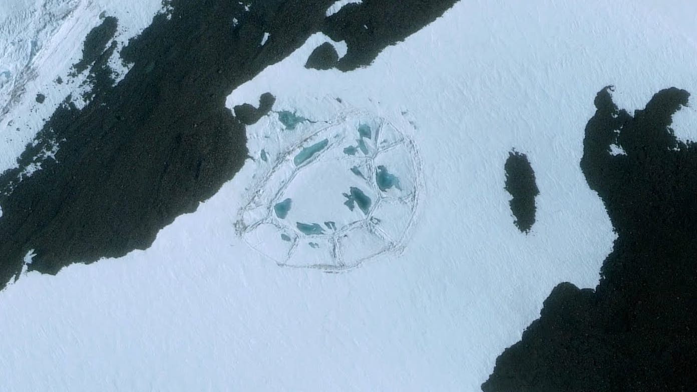
7. The Antarctic Ice Circle
It is truly fantastic that satellites can capture views of Antarctica, as it is a place few of us will ever get to visit. Really, how many of us would want to?
Getting to see Antarctic penguins in their natural habitat sounds fun, but otherwise I don’t see the appeal of visiting that particular continent. The coldest and driest place on Earth? I’ll pass, thanks.
There’s a strange and extremely large circular shape when viewing a portion of Antarctica from above. Why is it there? No one really knows.
Global warming has been suggested as a cause, or even the spot where a meteor hit the Earth. At point, it could have been a meltwater lake, which is currently the most likely explanation.
Only time will tell if the mystery of the Antarctic Ice Circle will ever be conclusively solved.
8. Kondyor Massif, Russia
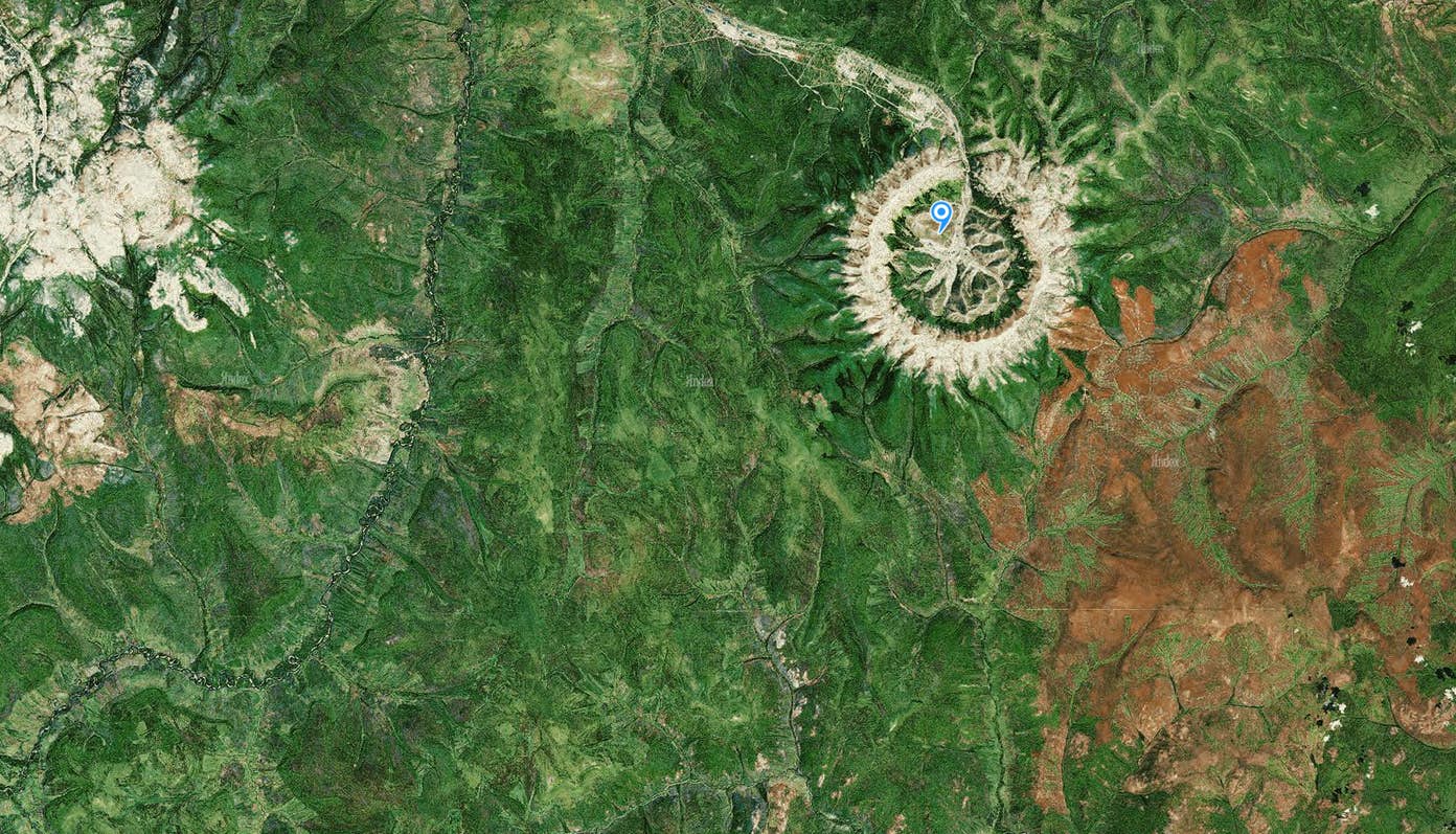
Found in the northwestern portion of Russia, Kondyor Massif is an excellent source of platinum as well as an erosion-caused landmass that—from above—appears to be an almost perfect circle. It is also a source of other precious metals, including silver, copper, and gold.
What’s curious about this impressive spot of Earth is that satellite maps of the surrounding area are very low-detail as well as low-resolution.
Why this is the case is anybody’s guess; if I had to guess, however, I’d guess that some organization is trying to protect the mineral deposits.
Leave a Comment